
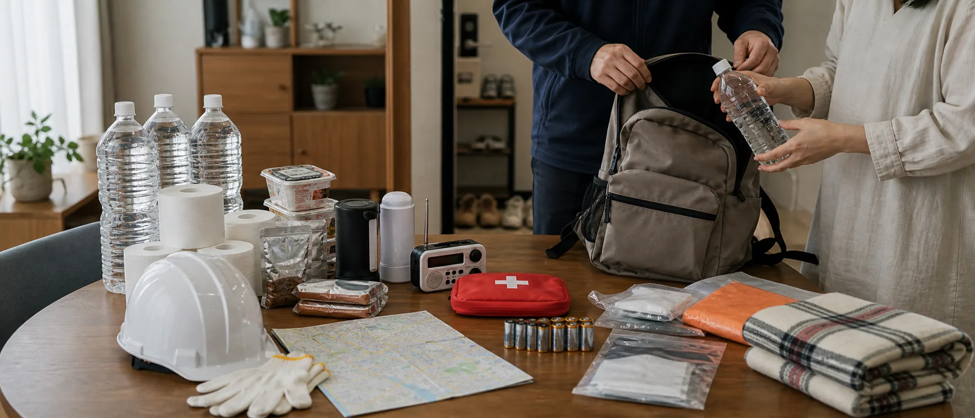
Japan Disaster Preparedness Checklist
Set emergency phone alerts, check hazard maps, separate evacuation sites from shelters, read warning levels 1 to 5, and keep 3 days of water, food, toilets, power, and paper contacts.
ARTICLE MAP Reading Map
Japan has more than 1,500 felt earthquakes in many years, plus the June to October typhoon season, northern snow disasters, landslides, floods, and volcanic risk. Preparedness is not one bag by the door. It is a five-layer setup: phone alerts, hazard map, evacuation destination, warning level, and 3 days of supplies.
Phone alerts and multilingual apps
The first alert path is 緊急速報メール, called Area Mail by docomo and Emergency Alert Mail by au and SoftBank. The Fire and Disaster Management Agency, FDMA, uses J-Alert to push urgent earthquake, tsunami, special weather warning, and armed-attack information to phones in the affected area.
On iPhone, check Settings, Notifications, and Emergency Alerts. On Android, the menu is usually Safety and emergency, Wireless emergency alerts, or carrier emergency mail settings. Phones bought outside Japan, SIM-free models, and some overseas Android devices may have alerts disabled by default.
Add Safety tips by JNTO for 15 languages including Chinese and English, evacuation-site maps, action flows, and phrase cards. NHK WORLD-JAPAN is useful during major events because multilingual news is easier to follow than only Japanese TV. For Japanese or English alerts with very fast earthquake delivery, the NERV disaster prevention app by Gehirn covers earthquakes, tsunami, volcanic eruption, heavy rain, river, tornado, and J-Alert information.
Source: FDMA: J-Alert, JNTO: Safety tips app, NERV Disaster Prevention App.
Hazard maps for the actual address
After alerts, check whether the home is in a flood, landslide, tsunami, storm-surge, earthquake, or dense-wooden-area risk zone. A GSI hazard layer can make a riverside apartment, hillside house, reclaimed-land tower, and old wooden district show completely different disaster problems.
The national entry point is the Hazard Map Portal Site by the Geospatial Information Authority of Japan, GSI. 重ねるハザードマップ lets users enter an address and layer multiple risks. わがまちハザードマップ links to the municipality’s official map.
Check the map before signing a 2025 lease. A first-floor wooden apartment inside a 3 m or deeper flood zone is a different housing decision from the same apartment on higher ground. Real-estate agents may not explain the practical evacuation route unless asked.
Source: GSI: Hazard Map Portal Site.
Evacuation sites and shelters
指定緊急避難場所 and 指定避難所 are different. A designated emergency evacuation site is where people go first to protect life during the hazard. It can be a park, schoolyard, plaza, high ground, or a rooftop of a resistant building.
The site is assigned by disaster type. A schoolyard can be correct for an earthquake but wrong for tsunami. A flood evacuation building may not be the same as a landslide evacuation point.
A designated shelter is for living after the immediate danger, often a 2025 municipal school gym. It is used when the home is collapsed, unsafe, or without water and power for days. Search the municipal page for 指定緊急避難場所 and 指定避難所, and save both near the home and workplace.
Source: GSI: Designated emergency evacuation site data.
Warning levels 1 to 5
Since 2019, flood and landslide evacuation information has been organized around 5 warning levels. Level 1 is early awareness from JMA. Level 2 is a heavy-rain or flood advisory. Level 3 is evacuation of older people and people needing extra time, issued by the municipality.
Level 4 is evacuation instruction. People in the affected area should leave for a safe place by this level. Level 5 is emergency safety securing under the JMA framework, meaning ordinary evacuation may already be impossible; move to an upper floor or the safest indoor area.
Level 5 is not guaranteed to be issued. Municipalities can fail to issue it before damage starts, so the practical rule on Japanese disaster pages is to complete evacuation by Level 4.
Source: JMA: Disaster information and warning levels.
Three days of supplies
Cabinet Office guidance commonly starts from 3 days at home. Water is 3 liters per person per day, so 9 liters per person for 3 days. That is about five 2-liter bottles per person.
Food should cover 9 meals per person in a 2025 household plan: alpha rice, retort pouches, canned food, biscuits, chocolate, hardtack, and nutrition bars. Keep 1 or 2 meals that require no heating. A cassette stove and 3 to 4 gas canisters make the remaining meals easier.
Portable toilets are the item many households miss. Cabinet Office materials often use 5 toilet uses per adult per day, so 15 uses per person for 3 days. A 50-use set with coagulant can cost around ¥3,000. Also keep a headlamp, radio, 20,000 mAh battery, ¥10,000 in small bills and coins, 1 week of medication, and paper contacts for family, work, and embassy or consulate.
Source: Cabinet Office: Disaster prevention information.
Common mistakes
Installing alert apps is not enough. Save hazard maps, emergency evacuation sites, and shelters for both home and workplace, because power or mobile data can fail at night.
Do not confuse evacuation sites with shelters. A schoolyard that works after an earthquake can be too low for tsunami or flood. Choose 2 destinations for each disaster type around the address.
Water and food alone leave a household stuck when toilets stop. Keep at least 15 portable toilet uses per person, a 20,000 mAh battery, JPY 10,000 in small bills and coins, and 1 week of medicine in the same kit.
Useful terms
- 緊急速報メール: emergency alert mail
- ハザードマップ: hazard map
- 指定緊急避難場所: emergency evacuation site
- 指定避難所: designated shelter
- 警戒レベル: warning level